2nd International Electronic Conference on Geosciences


Welcome from the Chair
I am pleased to announce that the 2nd International Electronic Conference on Geosciences (IECG 2019) will be held online from 8 to 15 June 2019. This electronic conference offers a forum for researchers engaged in the study of all interdisciplinary aspects of the earth and planetary sciences to present their research and exchange ideas with their colleagues. This online conference will allow you to participate without having to leave home, saving you time, travel and participation expenses while at the same time gaining new information on current research in geosciences.
This electronic conference concerns all subjects covered by the scope of the journal Geosciences (https://www.mdpi.com/journal/geosciences/about). In this second edition, the following selected themes will be covered more specifically:
- Statistical Seismology
- Tracers in Hydrogeology
- Earth Sciences through Earth Observation
- Paleontology and Biostratigraphy
- Planetary Geology and Earth Analogs
- Geologic Materials: Past, Present, and Future
- Modeling Hazards and Impacts from Extreme Storms
- Others
- Poster Session
This is a virtual conference held at www.sciforum.net/. Sciforum.net is a platform developed and sponsored by MDPI to organize electronic conferences and to provide our community with technical support for hosting digital conferences.
Participation is free of charge for both authors and attendees. Selected papers will be published in the Special Issue "Selected Papers from the 2nd International Electronic Conference on Geosciences" in Geosciences. Geosciences (ISSN 2076-3263) is an international, peer-reviewed, open access journal of geoscience and future earth and planetary science, published monthly online by MDPI. It is covered by some important databases, such as Emerging Sources Citation Index (ESCI)—Web of Science (Clarivate Analytics), Scopus (Elsevier), GeoRef (American Geosciences Institute), AGORA (FAO), CAS—Chemical Abstracts (ACS) and DOAJ—Directory of Open Access Journals. We have a citescore of 1.97 in Scopus and currently rank Q2 in Earth and Planetary Sciences (miscellaneous) in SCImago.
I am looking forward to participating in exciting discussions, hearing new ideas and perspectives in the field, and welcoming all participants to the online conference.
Kind regards,
Prof. Dr. Jesus Martinez-Frias
Chair of the 2nd International Electronic Conference on Geosciences
Editor-in-Chief of Geosciences
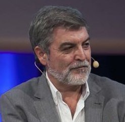
Prof. Jesús Martínez Frías
Prof. Jesús Martínez Frías, PhD (Complutense University of Madrid/1986) did several stays of research in the UK (University of Leeds), Canada (University of Toronto), Germany (University of Heidelberg) and the USA (University of California). He is Scientific Researcher at the Geosciences Institute, IGEO (CSIC-UCM); Honorific Professor at the Bioengeneering and Aerospace Engineering Department of the Universidad Carlos III de Madrid; Head of the Research Group of Meteorites and Planetary Geosciences and founder; and Director of the Spanish Planetology and Astrobiology Network (REDESPA). He has participated in more than 40 projects and scientific campaigns (e.g., Antarctica, Mauritania, Iceland, Costa Rica). In 2002, he participated in the NASA flight to study the Leonid Meteor Shower. He is co-I in NASA-MSL (rover Curiosity), ESA-ExoMars and NASA-Mars2020, and in 2016, 2017 and 2018, he was instructor of ESA astronauts in the PANGAEA program (Lanzarote and Chinijo Islands UNESCO Global Geopark). He has published nine books and more than 200 articles (Science, Nature, Geology, etc.). He was a Former Member of the UN ECOSOC Committee on Natural Resources, Ex-ViceChair of the UNCSTD and Ex-Chair of IUGS-COGE (Commission on Geoscience Education, Training and Technology Transfer). He is an OC Member of the IAU Astrobiology Commission and member of the Inter-Commission C1-F2-F3-H2 WG Education and Training in Astrobiology. Co-founder and President of the International Association for Geoethics (IAGETH). He is the Editor-in-Chief of the journal Geosciences (MDPI) and co-editor of the Springer Book Series: Geoheritage, Geoparks and Geotourism. He has received several awards and recognitions (i.e., NASA, ESA, GSAf (Goodwill Ambassador), ArabGU, Spanish Association of Scientists).
Conference Secretariat
Ms. Daisy Hu,MDPI Branch Office, Wuhan
E-Mail: iecg2019@mdpi.com
Sponsoring Opportunities
For information regarding sponsoring opportunities, please contact Ms. Daisy Hu.
E-Mail: iecg2019@mdpi.com
Conference Chairs


Instituto de Geociencias, IGEO (CSIC-UCM), C/ Del Doctor Severo Ochoa 7, Facultad de Medicina (Edificio Entrepabellones 7 y 8), 28040 Madrid, Spain
j.m.frias@igeo.ucm-csic.es
Conference Committee


Natural Resource Development with Environmental Protection I2M Associates, LLC 1810 Elmen Street, Houston, TX 77019, USA
mdc@i2massociates.com


School of Geosciences, University of South Florida, 4204 E Fowler Ave., NES 107, Tampa, FL 33620, USA
rpu@usf.edu


Departament of Earth Sciences, Faculty of Sciences and Technology (Polo II), University of Coimbra, Rua Sílvio Lima, 3039-790 Coimbra, Portugal
hhenriq@dct.uc.pt

Department of Environmental Sciences, University of Virginia, Charlottesville, VA 22903, USA
sam8f@virginia.edu


deodato.tapete@gmail.com

rohini.kumar@ufz.de
LandS/Lab2PT - Landscape, Heritage and Territory Laboratory (FCT UID/AUR/04509/2013; FEDER COMPETE POCI-01-0145-FEDER-007528) and Earth Sciences Department, School of Sciences, University of Minho, 4710-057 Braga, Portugal
casaix@dct.uminho.pt
Sessions
B. Tracers in Hydrogeology
C. Earth Sciences through Earth Observation
D. Paleontology and Biostratigraphy
E. Planetary Geology and Earth Analogs
F. Geologic Materials: Past, Present, and Future
G. Modeling Hazards and Impacts from Extreme Storms
H. Others
I. Poster Session
Instructions for Authors
Submissions should be done by the authors online by registering with www.sciforum.net, and using the "Start New Submission" function once logged into system.
- Scholars interested in participating in the conference can submit their abstract (about 200-250 words covering the areas indicated for the Proceedings issue) online on this website until 18 April 2019 .
- The Conference Committee will pre-evaluate, on the basis of the submitted abstract, whether a contribution from the authors of the abstract will be accepted for the 2nd International Electronic Conference on Geosciences.
- If the abstract is accepted for this conference, the author is asked to submit the manuscript, optionally along with a PowerPoint and/or video presentation of his/her paper (only PDF), until the submission deadline of 25 May 2019.
- The conference proceedings papers and presentations will be available online for discussion during the time of the conference 8–15 June 2019. The accepted papers will be published in the Journal Proceedings. After the conference, the authors are recommended to submit an extended version (30-50%) of the proceeding papers to the journal Geosciences, benefiting from a 20% discount on the APC charges.
Manuscripts for the Proceedings issue must have the following organization:
First page:
- Title
- Full author names
- Affiliations (including full postal address) and authors' e-mail addresses
- Abstract
- Keywords
- Introduction
- Methods
- Results and Discussion
- Conclusions
- (Acknowledgements)
- References
The manuscripts should be prepared in MS Word or any other word processor and should be converted to the PDF format before submission. The publication format will be PDF. The length of the manuscript is maximum 6 pages, and authors are asked to keep their papers as concise as possible.
Authors are encouraged to prepare a presentation in PowerPoint or similar software, to be displayed online along with the manuscript. Slides, if available, will be displayed directly in the website using Sciforum.net's proprietary slides viewer. The slides can be prepared in exactly the same way as for any traditional conference where research results can be presented. The slides should be converted to the PDF format before submission so that our process can easily and automatically convert them for online displaying.
Besides their active participation within the forum, authors are also encouraged to submit video presentations. If you are interested in submitting, please contact the conference secretary Daisy Hu at iecg2019@mdpi.com to get to know more about the procedure. This is a unique way of presenting your paper and discuss it with peers from all over the world. Make a difference and join us for this project!
Posters will be available on this conference website during and after the event. As for papers presented in the conference, the participants will be able to ask questions and make comments about the posters. Posters that are submitted without a manuscript will not be included in the Proceedings of the conference.
Manuscripts should be submitted online at www.sciforum.net/login by registering and logging in to this website.
Microsoft Word
Authors must use the Microsoft Word template to prepare their manuscript. Using the template file will substantially shorten the time to complete copy-editing and publication of accepted manuscripts. Manuscript prepared in MS Word must be converted into a single file before submission. Please do not insert any graphics (schemes, figures, etc.) into a movable frame which can superimpose the text and make the layout very difficult.
Manuscript Preparation
- Paper Format: A4 paper format, the printing area is 17.5 cm x 26.2 cm. The margins should be 1.75 cm on each side of the paper (top, bottom, left, and right sides).
- Formatting / Style: Papers should be prepared following the style of IECMS2018 template. The full titles and the cited papers must be given. Reference numbers should be placed in square brackets [ ], and placed before the punctuation; for example [4] or [1-3], and all the references should be listed separately and as the last section at the end of the manuscript.
- Authors List and Affiliation Format: Authors' full first and last names must be given. Abbreviated middle name can be added. For papers written by various contributors a corresponding author must be designated. The PubMed/MEDLINE format is used for affiliations: complete street address information including city, zip code, state/province, country, and email address should be added. All authors who contributed significantly to the manuscript (including writing a section) should be listed on the first page of the manuscript, below the title of the article. Other parties, who provided only minor contributions, should be listed under Acknowledgments only. A minor contribution might be a discussion with the author, reading through the draft of the manuscript, or performing English corrections.
- Figures, Schemes and Tables: Authors are encouraged to prepare figures and schemes in color. Full color graphics will be published free of charge. Figure and schemes must be numbered (Figure 1, Scheme I, Figure 2, Scheme II, etc.) and a explanatory title must be added. Tables should be inserted into the main text, and numbers and titles for all tables supplied. All table columns should have an explanatory heading. Please supply legends for all figures, schemes and tables. The legends should be prepared as a separate paragraph of the main text and placed in the main text before a table, a figure or a scheme.
For further inquiries please contact the Conference Secretariat.
It is the authors' responsibility to identify and declare any personal circumstances or interests that may be perceived as inappropriately influencing the representation or interpretation of clinical research. If there is no conflict, please state here "The authors declare no conflict of interest." This should be conveyed in a separate "Conflict of Interest" statement preceding the "Acknowledgments" and "References" sections at the end of the manuscript. Financial support for the study must be fully disclosed under "Acknowledgments" section. It is the authors' responsibility to identify and declare any personal circumstances or interests that may be perceived as inappropriately influencing the representation or interpretation of clinical research. If there is no conflict, please state here "The authors declare no conflict of interest." This should be conveyed in a separate "Conflict of Interest" statement preceding the "Acknowledgments" and "References" sections at the end of the manuscript. Financial support for the study must be fully disclosed under "Acknowledgments" section.
MDPI, the publisher of the Sciforum.net platform, is an open access publisher. We believe that authors should retain the copyright to their scholarly works. Hence, by submitting a Communication paper to this conference, you retain the copyright of your paper, but you grant MDPI the non-exclusive right to publish this paper online on the Sciforum.net platform. This means you can easily submit your paper to any scientific journal at a later stage and transfer the copyright to its publisher (if required by that publisher).
List of accepted submissions (36)
| Id | Title | Authors | Poster PDF | |
|---|---|---|---|---|
| sciforum-024066 | GEOLOGICAL RAW MATERIALS FROM A MESOLITHIC ARCHAEOLOGICAL SITE IN NW PORTUGAL | , , | N/A |
Show Abstract |
| sciforum-025197 | Nonlinear Dynamics of seismicity and fault zone strain around large dam: the case of Enguri dam, Caucasus. |

|
Show Abstract |
|
| sciforum-025235 | GEOLOGICAL MATERIALS AS SOURCES OF Rn EMISSIONS | , | N/A |
Show Abstract |
| sciforum-025246 | Natural time analysis: Results related to two earthquakes that occurred in Greece during 2019 | , , | N/A |
Show Abstract |
| sciforum-025283 | Eocene North American Testudinidae and Geoemydidae (Retilia, Testudines): A re-evaluation of their alpha taxonomy and paleogeography | , , |

|
Show Abstract |

Sponsors and Partners
Sponsors


